
Today was International Open Data Day and I took the chance to work on a How-To for a visualization I built quite a while ago. It originally stems from Mappable, an initiative in Hamburg.
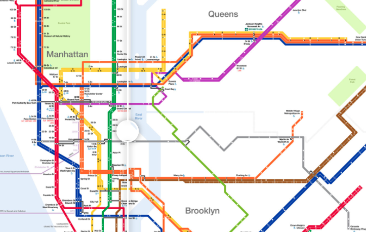
The access map visualizes in a very powerful way the perspective of people that are dependent on accessibility in the public transport system. It lets you move a slider over a map and thus wipes out all the stations that are not visible. Mappable used the tool TwentyTwenty for that, a really cool jQuery plugin.
I redeployed this for Berlin, which is hardly as terrifying as the cities of New York or London which are practically empty then. So kudos to Berlin and the BVG!
As mappable notes on their blog, there are already apps that support people with limited mobility, like the gorgeous app wheelmap. But I agree with them on the notion, that this is incredibly helpful to deal with the current situation, but not a long-term solution to the problem. Instead, it would be great if we were working on making cities more accessible, so that someday, there won’t be the need for such a tool anymore.
Hence I wanted to contribute a little by writing a how-to that is easy to understand by people who do not code but want to make a statement on their city’s accessibility. I configured my repo and code in a way that makes it really simple – you just need to copy my repository to your own github account and it’ll be hosted and online on github pages automatically.
I would love to see that app being deployed in as many cities as possible. You can find the repository and the read me here.
Please contact me if you have any questions.
![]()